High School Bearings Scale and Loci Worksheets
All worksheets are created by the team of experienced teachers at Cazoom Math.
What topics do loci worksheets typically cover for high school students?
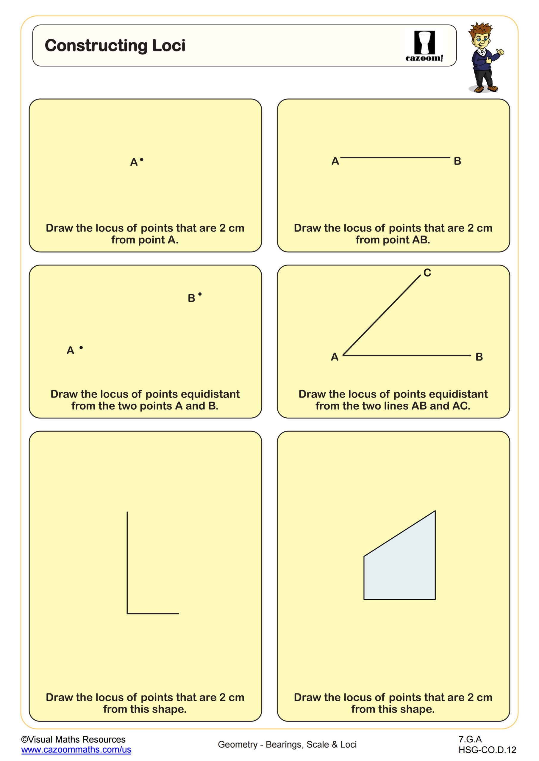
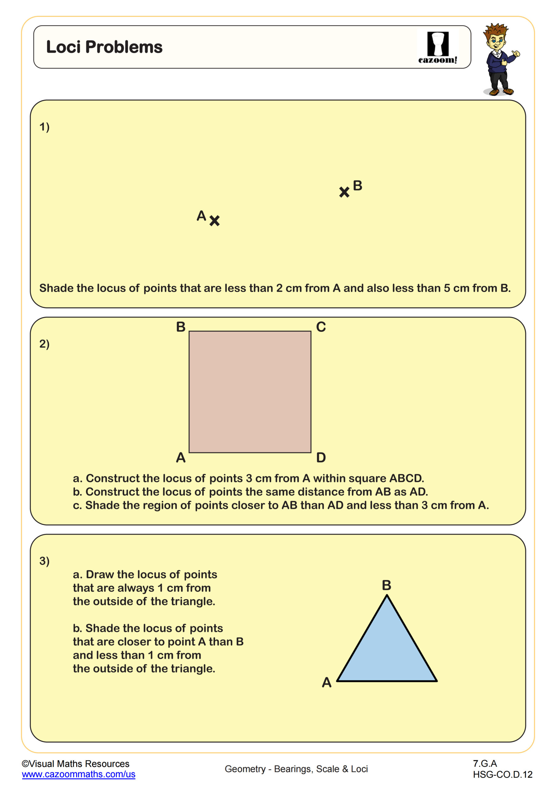
High school loci worksheets focus on constructing and identifying sets of points that satisfy specific geometric conditions. Students practice finding loci for points equidistant from two fixed points, points at constant distances from lines or circles, and angle bisector constructions. The curriculum typically aligns with Common Core geometry standards covering geometric constructions and coordinate geometry applications.
Teachers frequently notice students confuse individual points with entire loci sets, especially when working with perpendicular bisectors. Many students initially plot single points instead of drawing complete lines or curves representing all possible locations. Effective worksheets progress from simple distance-based loci to more complex problems involving multiple constraints and intersection points.
Which grade levels benefit most from bearings and loci practice?
Bearings and loci concepts typically appear in grades 9-12 geometry and advanced algebra courses, with some introduction in grade 8 for accelerated programs. Most teachers introduce basic compass directions and simple loci in freshman geometry before advancing to three-figure bearings and complex loci constructions in upper-level courses. The topic connects well with coordinate geometry units and trigonometry applications.
Teachers observe that students with strong spatial reasoning skills from middle school geometry foundations handle these concepts more readily. Students who struggled with angle measurement and geometric construction tools often need additional scaffolding when encountering bearing problems. Many teachers find success introducing bearings through real-world navigation examples before moving to abstract geometric applications.
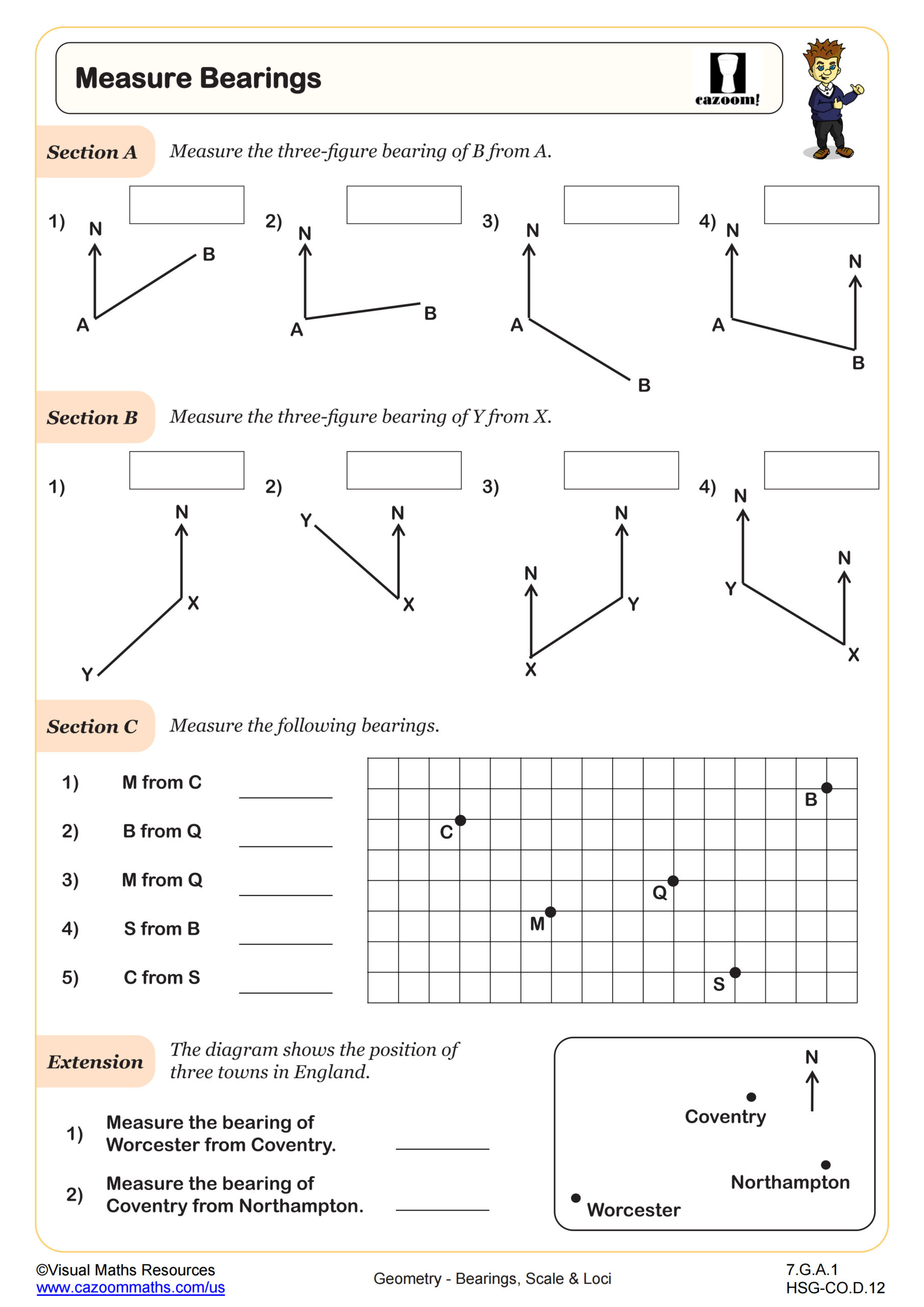
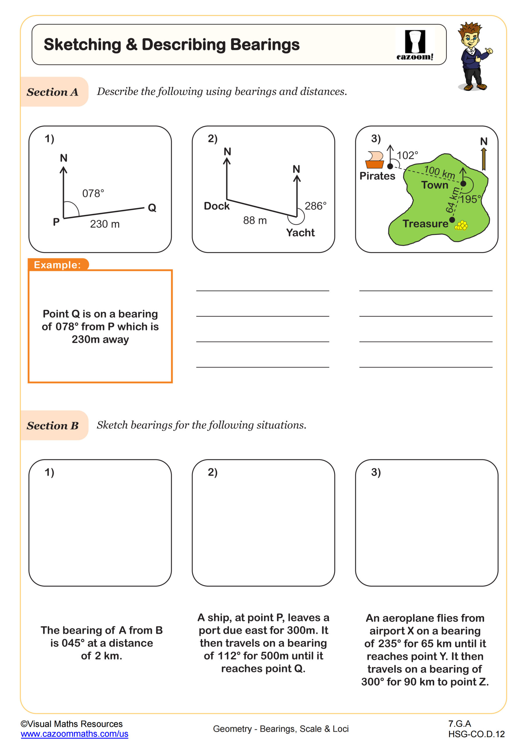
How do three-figure bearings differ from compass bearing notation?
Three-figure bearings measure clockwise angles from north using exactly three digits, while compass bearings reference cardinal directions with acute angle measurements. For example, southeast 30 degrees in compass notation becomes bearing 150 degrees in three-figure format. Students must understand that three-figure bearings always start from north and measure clockwise to avoid common conversion errors.
Teachers consistently notice students mixing up the two systems, particularly when converting compass bearings like "N30E" into three-figure format. Many students incorrectly assume compass bearings always measure from the nearest cardinal direction. Effective practice sheets include conversion problems alongside bearing calculation exercises to reinforce the relationship between both notation systems.
What makes bearings and loci worksheets effective for classroom instruction?
Effective bearings and loci worksheets combine construction practice with analytical problem-solving, helping students develop both geometric reasoning and computational skills. Teachers find success using worksheets that progress from basic compass work to coordinate plane applications, allowing students to visualize abstract concepts through hands-on construction activities. Answer keys with step-by-step solutions help teachers identify common errors quickly.
Many teachers observe improved student understanding when worksheets include real-world contexts like GPS navigation or architectural design problems. Students connect better with bearing calculations when they see applications in aviation, maritime navigation, or surveying. Worksheets that combine traditional compass-and-straightedge constructions with coordinate geometry problems prepare students for both standardized assessments and practical STEM applications.