High School Scale & Loci Worksheets
All worksheets are created by the team of experienced teachers at Cazoom Math.
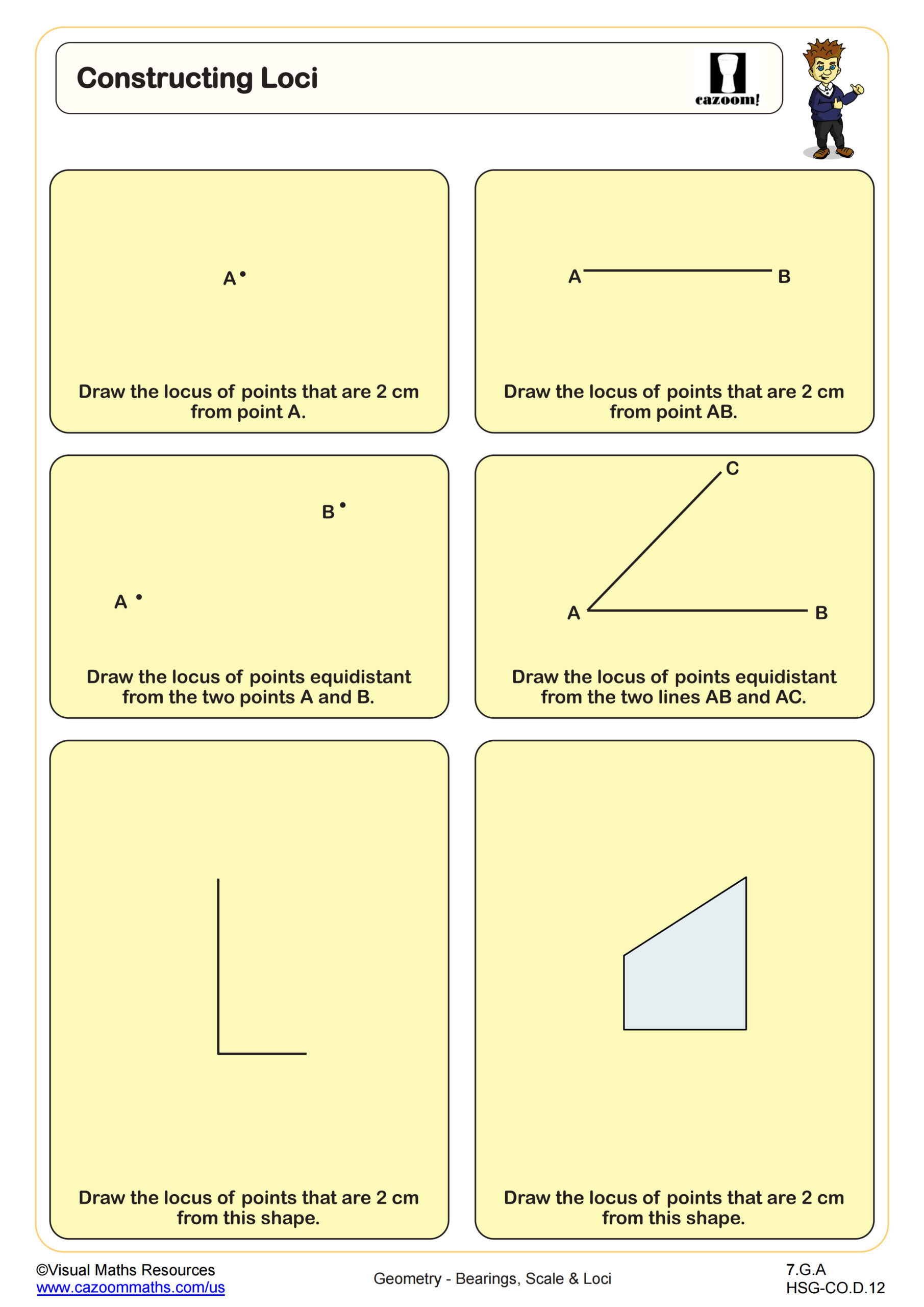
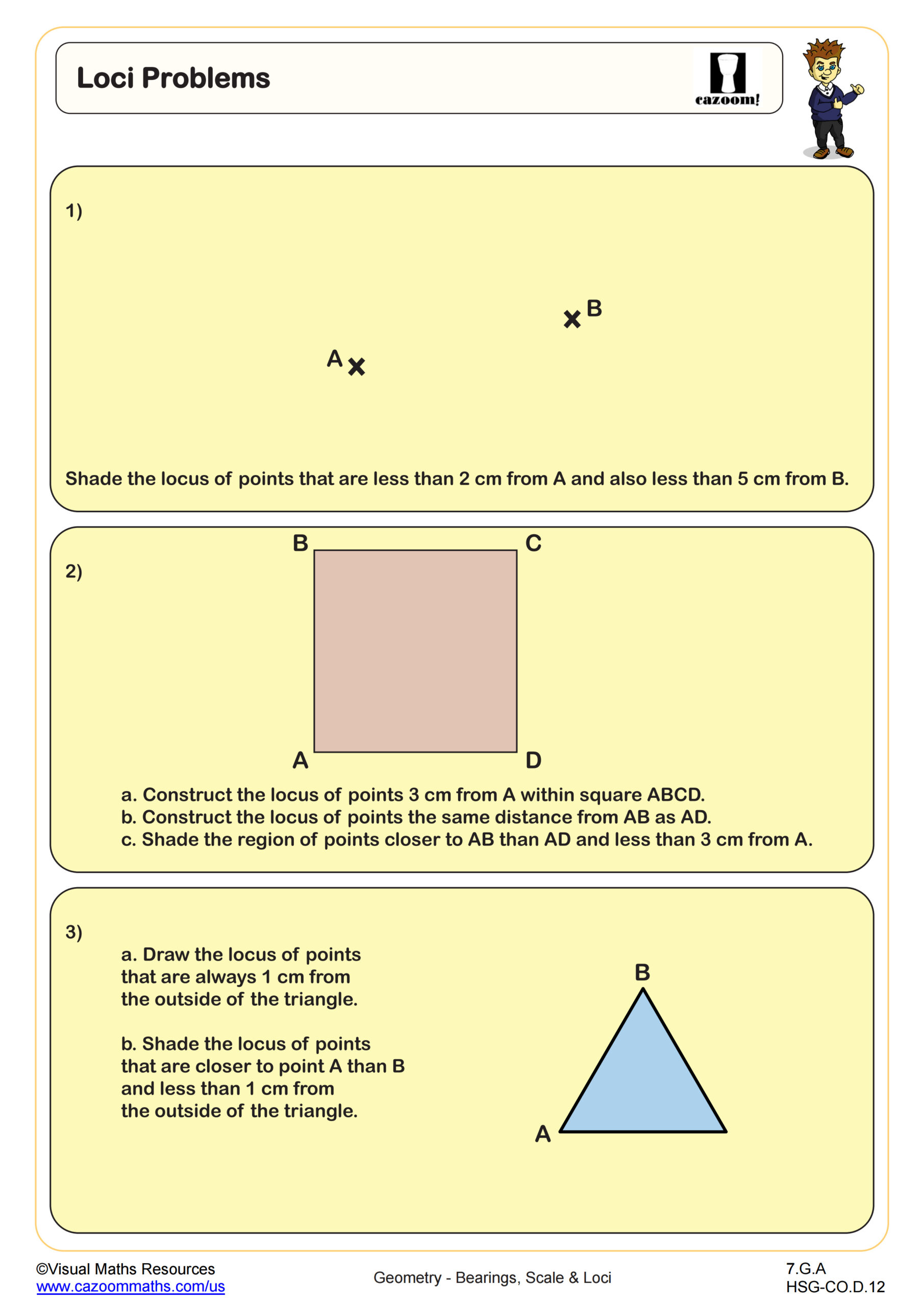
What are loci in geometry and why do students study them?
A locus (plural: loci) represents all points that satisfy a specific condition or set of conditions. In high school geometry, students learn to construct loci such as the perpendicular bisector of a line segment (all points equidistant from two endpoints), the angle bisector (all points equidistant from two lines), or points at a fixed distance from a given point or line. These concepts connect directly to Common Core standards for geometric constructions and appear regularly on state assessments.
Students frequently make the connection between loci and optimization problems once they realize that finding a location equidistant from three towns, for example, requires constructing perpendicular bisectors to locate the circumcenter. Teachers notice that students lose points when their compass work lacks precision or when they fail to show construction marks that prove their method. The ability to visualize and construct loci strengthens spatial reasoning skills essential for advanced mathematics and engineering fields.
Which grade levels cover scale and loci concepts?
These worksheets support high school courses including Geometry, Algebra I, Algebra II, Precalculus, and Integrated Math 1, 2, and 3. Geometry classes typically introduce bearings, scale drawings, and loci construction as part of their transformations and constructions units, while Integrated Math courses weave these topics throughout multiple years depending on state implementation of curriculum standards.
The progression across courses moves from basic bearing calculations and simple scale problems in earlier courses to more complex multi-step word problems and compound loci in later courses. Students in Geometry might work with single bearing measurements and straightforward scale conversions, while Precalculus students tackle navigation problems requiring multiple bearing calculations and trigonometric applications. Teachers adapting worksheets across grade levels often adjust the complexity of numerical values and the number of steps required to reach solutions.
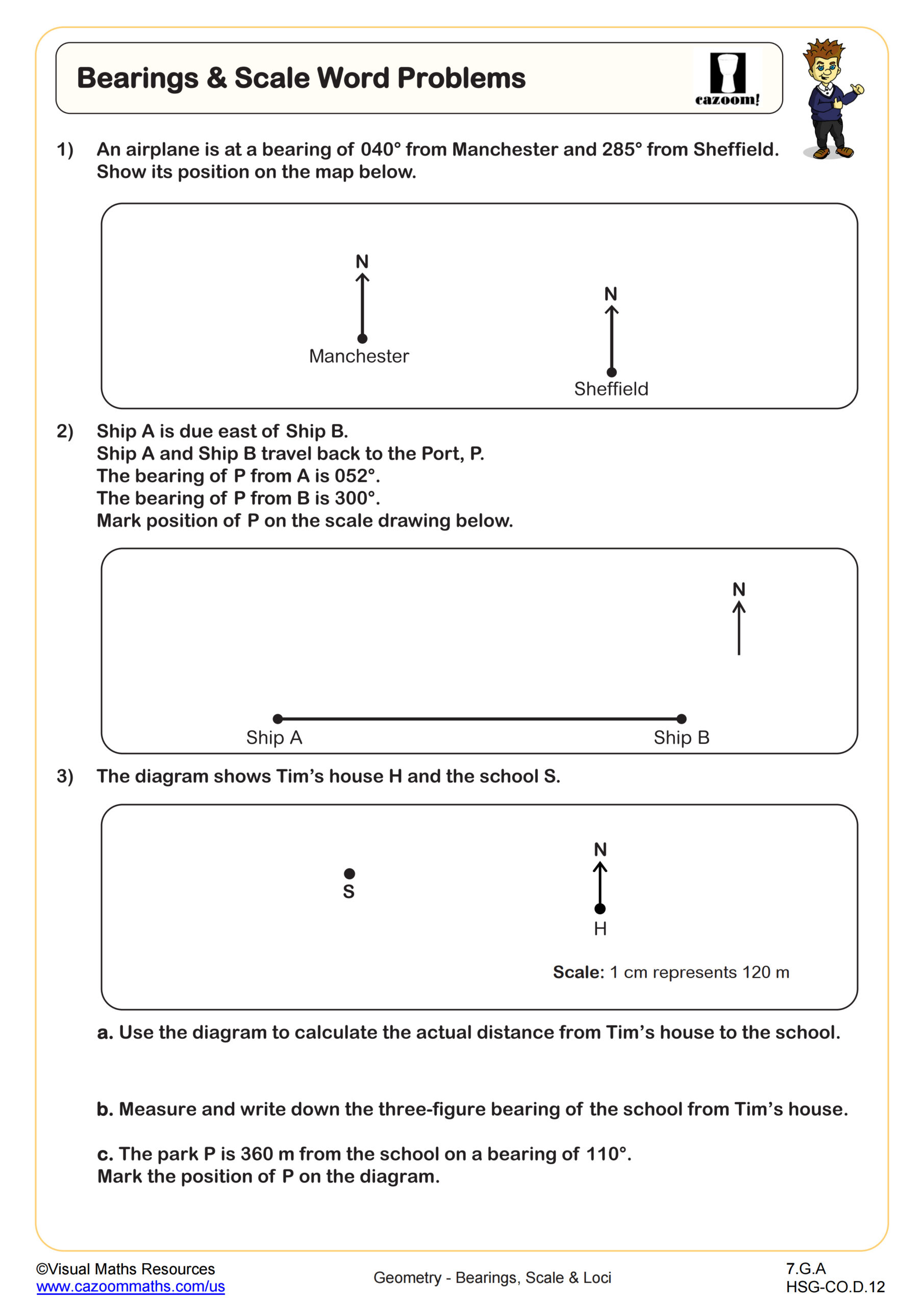
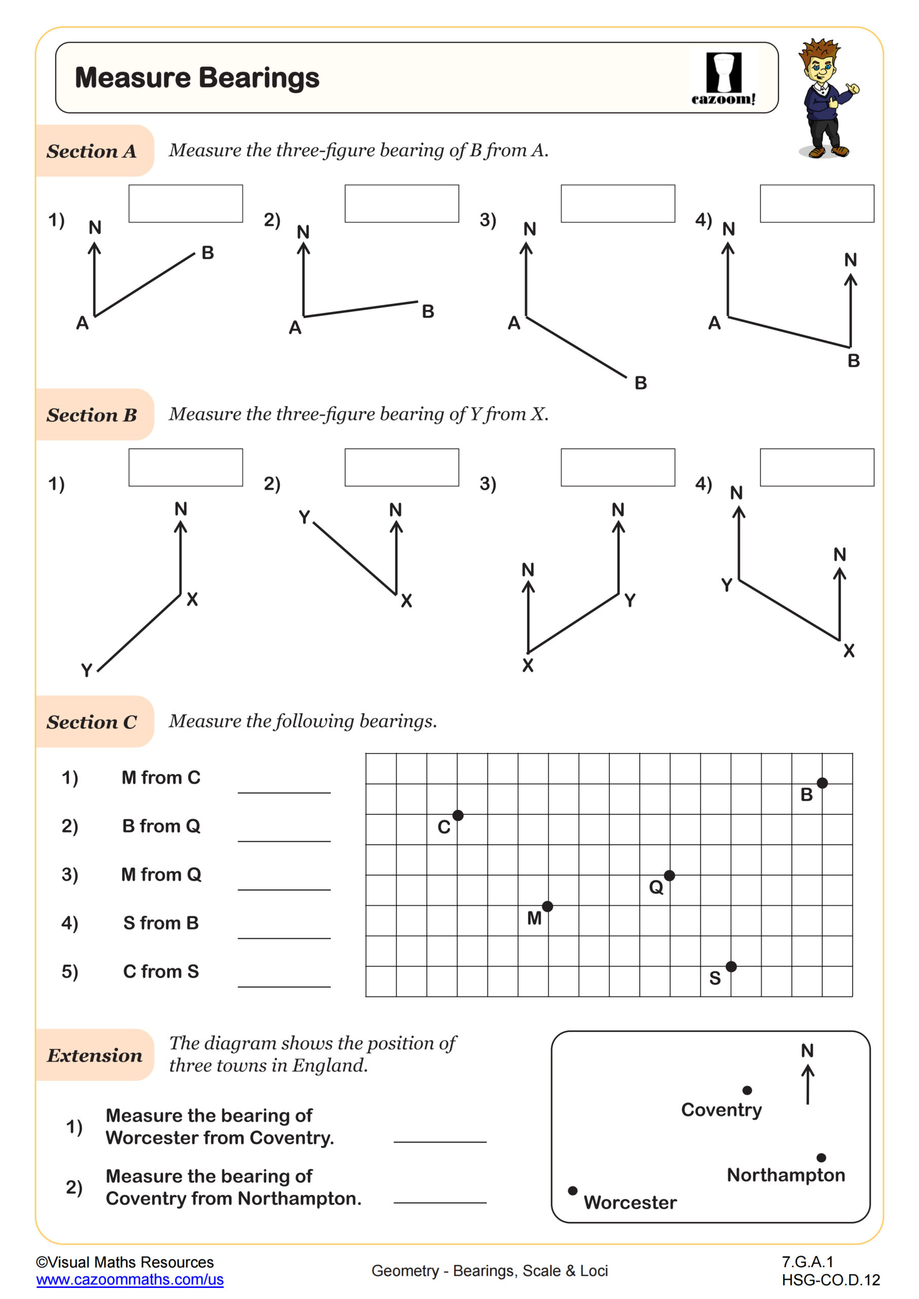
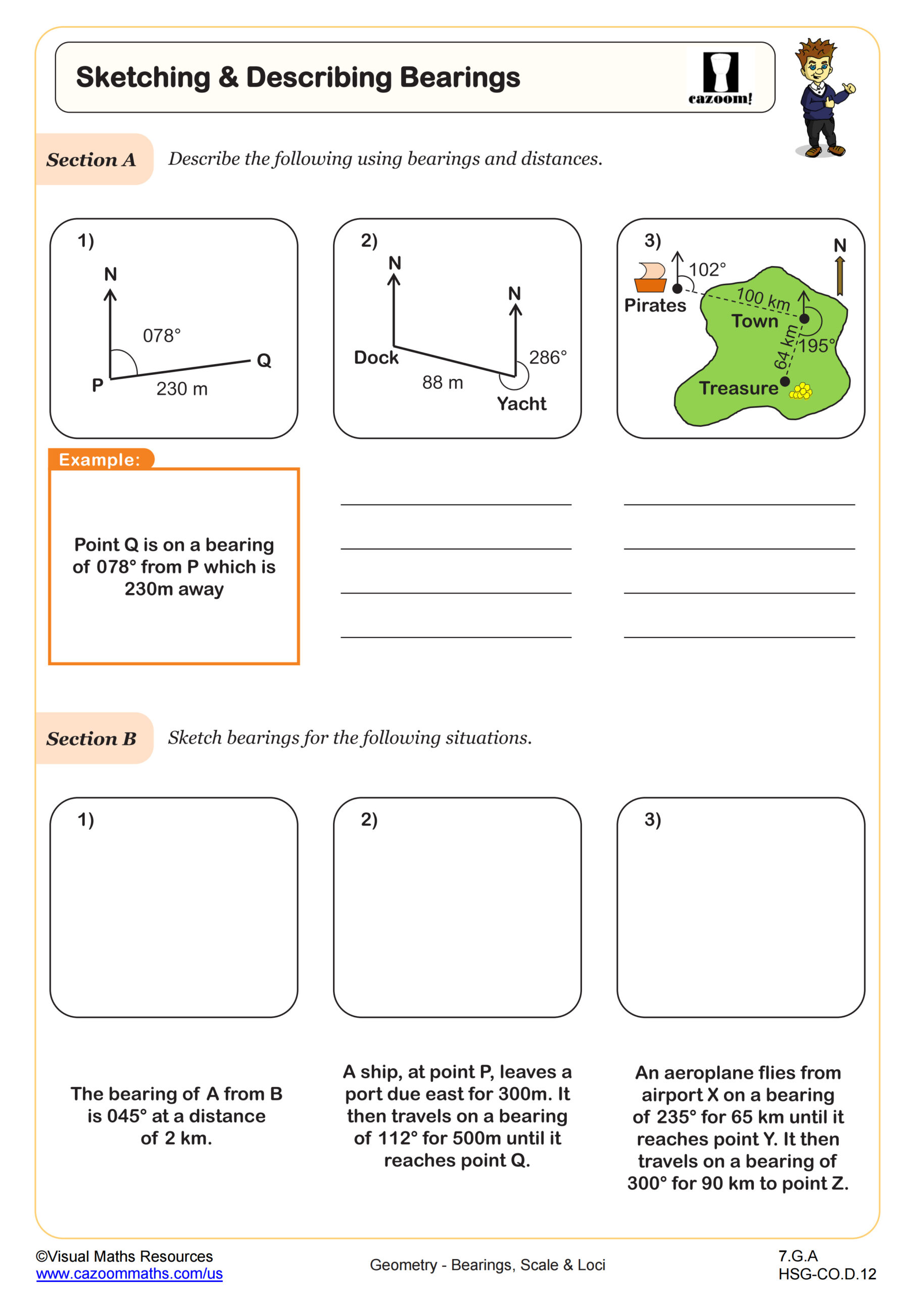
How do three-figure bearings work in navigation problems?
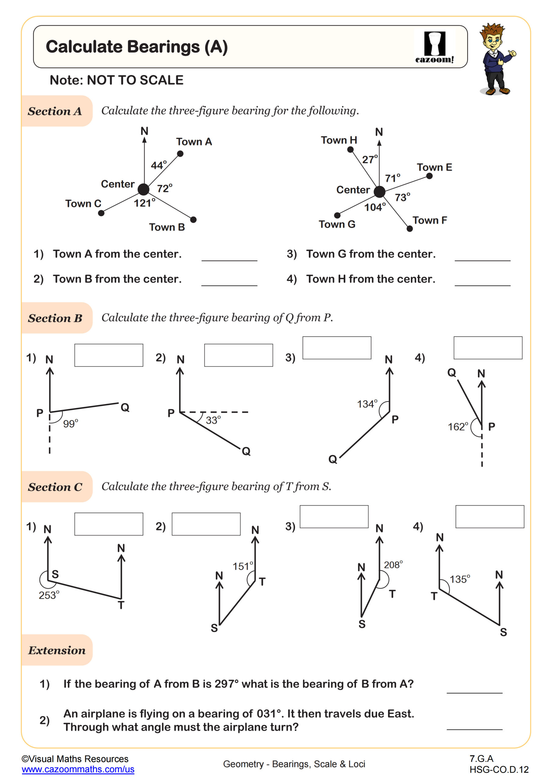
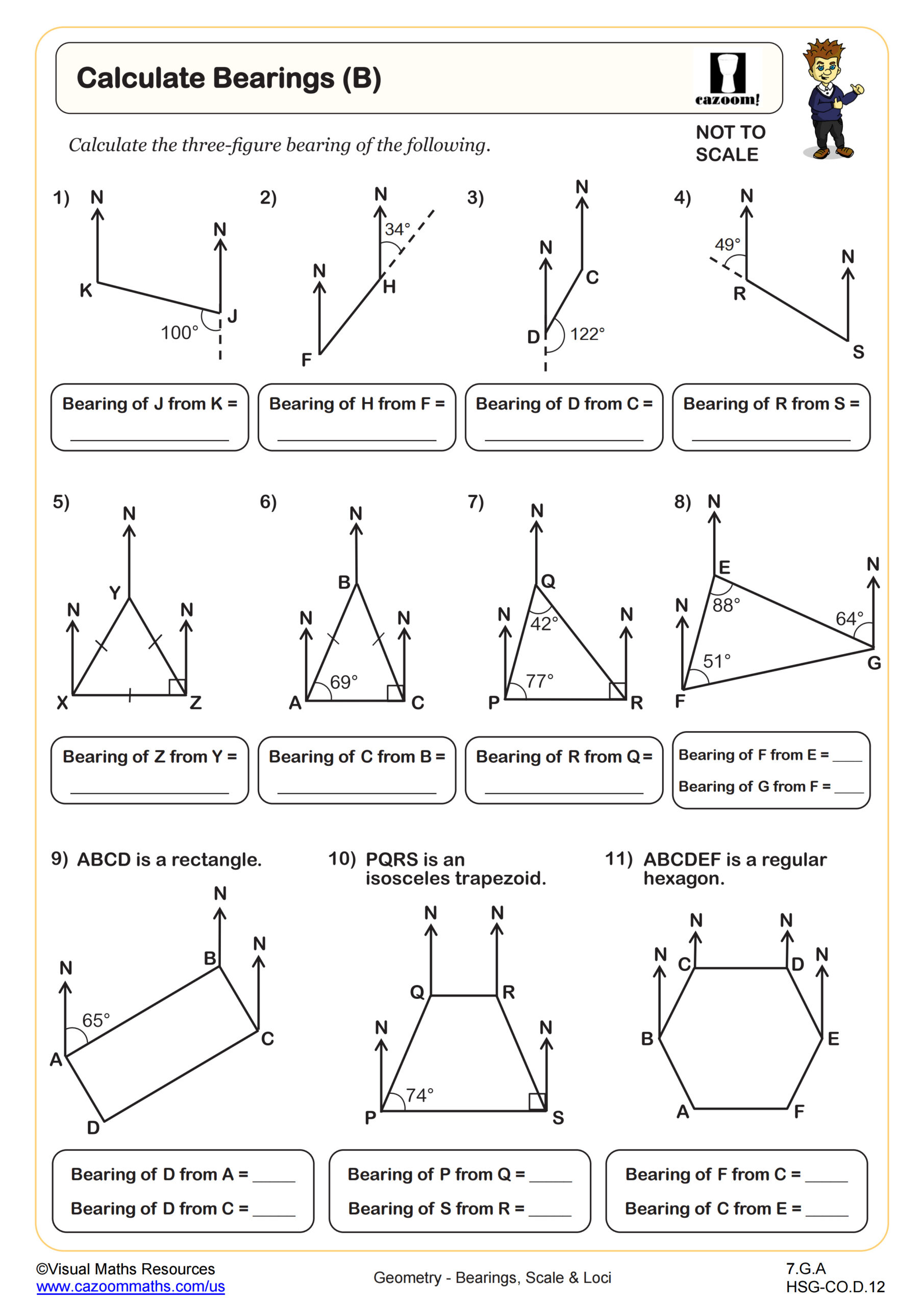
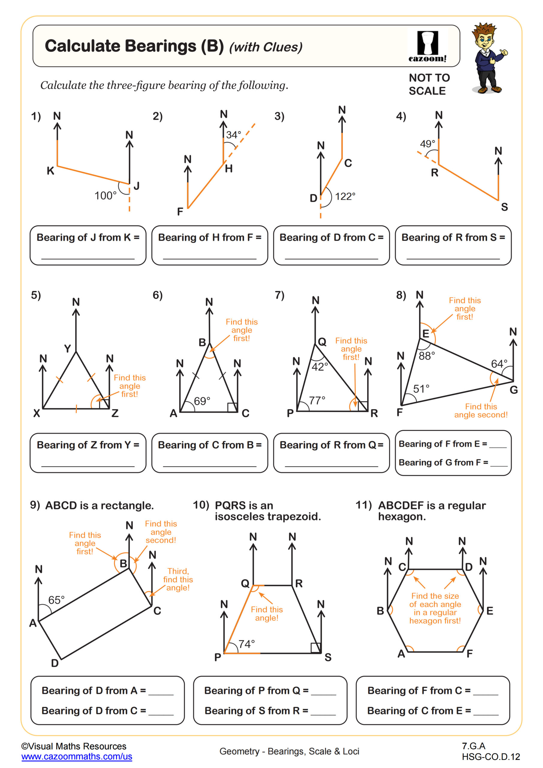
Three-figure bearings measure direction as angles from 0° to 360°, always measured clockwise from north and written with three digits (for example, 045° or 205°). Students learn that north is 000°, east is 090°, south is 180°, and west is 270°. The most common error occurs when students measure bearings from the wrong reference point or forget that bearings always start from north, not from the observer's current direction.
Pilots, ship captains, and land surveyors use bearings daily to navigate and map terrain accurately. In aviation, air traffic controllers provide bearing instructions to guide aircraft safely between waypoints, while surveyors establish property boundaries by recording distances and bearings from known reference points. Standardized tests expect students to convert between bearings and coordinate geometry, calculate back bearings (adding or subtracting 180°), and apply the Pythagorean theorem or trigonometry to find distances when bearings and one distance are known.
How can teachers use these scale and loci worksheets effectively?
The worksheets scaffold learning by separating bearing calculations into levels A and B, with the B-level adding clues that require multi-step reasoning before students can determine the bearing. Constructing loci worksheets provide geometric construction practice with clear diagrams, while word problems integrate scale factors with bearing calculations to mirror real-world applications. Answer keys allow students to check their construction accuracy and verify that calculated bearings match expected solutions.
Many teachers use the bearing calculation worksheets for warm-up practice at the start of navigation units, then assign loci construction problems during geometry review sessions before state assessments. The word problem worksheets work well for paired activities where students must explain their reasoning to partners, helping them articulate the connection between scale representations and actual distances. Teachers also find these materials valuable for intervention sessions with students who struggle with directional reasoning or for homework assignments that reinforce classroom instruction without requiring additional teacher-created resources.